
Questions about whether Hurricane Polo could influence El Niño and the weather around Chester are understandable. A powerful tropical storm can attract attention well beyond the area where it develops, particularly when people are already wondering whether autumn in Cheshire will be wet, windy or unusually warm.
The short answer is that one hurricane is very unlikely to change El Niño on its own. El Niño is part of a much larger Pacific Ocean and atmosphere pattern, while a hurricane is a relatively short-lived weather system. However, tropical storms can interact with the wider atmosphere, so scientists do examine them alongside other factors when assessing seasonal weather patterns.
That does not mean Hurricane Polo can provide a reliable weather forecast for Chester this autumn. Several months ahead, forecasters can discuss broad probabilities, but they cannot accurately predict the weather on a particular day in Chester, Handbridge, Hoole or the surrounding Cheshire villages.
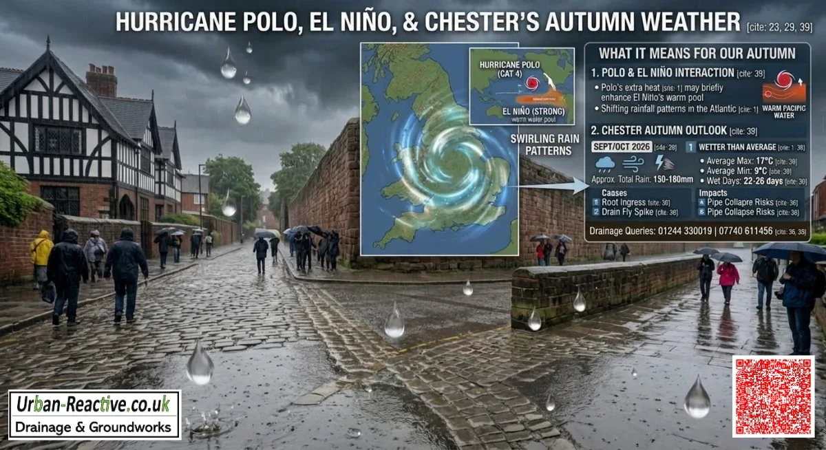
What is El Niño?
El Niño is the warm phase of the El Niño–Southern Oscillation, commonly shortened to ENSO. It involves unusually warm sea temperatures across parts of the central and eastern tropical Pacific, together with changes in the tropical atmosphere.
These changes can influence the position and strength of the jet stream, pressure patterns and rainfall in different parts of the world. The effects are not identical every time, and other influences can modify them, including the North Atlantic Oscillation, sea temperatures around the North Atlantic, and Arctic conditions.
It is important not to treat El Niño as a switch that simply turns British rain or sunshine on and off. It changes the odds of certain broad patterns; it does not determine every weather event. This is the key point when considering how hurricanes and El Niño are connected.
Will Hurricane Polo affect El Niño?
In practical terms, the answer is probably no. An individual hurricane generally does not contain enough energy, last long enough or occur in the right location to reverse or create an ENSO event by itself.
El Niño develops through large-scale ocean–atmosphere interactions over the tropical Pacific. Scientists monitor its evolution using ocean temperatures, winds, pressure, and other observations across a wide region. A storm in another tropical basin is only one small part of that much larger system.
That said, tropical storms and global weather are not completely separate. A hurricane can release heat and moisture into the atmosphere and may influence upper-level winds for a time. A succession of storms, or an unusually active tropical season, may also be associated with broader circulation patterns. These connections are complex and do not provide a dependable cause-and-effect link between Hurricane Polo and autumn weather in Chester.
So, when asking whether Hurricane Polo will affect El Niño, the sensible scientific answer is that it may be considered part of the wider atmospheric picture, but it is very unlikely to control the ENSO cycle.
How can El Niño influence British weather?
El Niño’s effects on British weather are usually indirect. Atmospheric waves travelling from the Pacific can affect the jet stream and pressure patterns over the Atlantic and Europe. Depending on the event’s strength and timing, this may slightly increase the likelihood of particular seasonal patterns.
For the UK, the signal is often weaker than it is in regions closer to the tropical Pacific. Other patterns may overwhelm it completely during a particular month. A developing Atlantic low-pressure system, a change in the North Atlantic Oscillation or a blocking area of high pressure can all have a more immediate effect on our weather.
This is why two autumns with a similar El Niño classification can still feel very different in Britain. One may bring frequent Atlantic fronts and heavy rain, while another includes settled spells, chilly nights and occasional stormy periods. Any possible impact of Hurricane Polo on UK weather would need to be assessed through these wider atmospheric patterns rather than inferred from the storm’s name.
What might this mean for Chester and Cheshire this autumn?
Homeowners usually want to understand four parts of the forecast: temperature, rainfall, wind and storminess. At long range, each needs to be expressed cautiously. This is why an autumn weather outlook for Cheshire can describe broad probabilities but cannot provide a day-by-day local prediction.
Temperature
El Niño may alter the seasonal odds for warmer or cooler conditions in parts of the UK, but it cannot tell us whether Chester will have a mild October weekend or an early frost in November. Local temperatures are strongly affected by cloud cover, wind direction, elevation and overnight conditions.
Chester and nearby areas may also experience different conditions from the UK average. A broad North-West England outlook is not a precise forecast for an individual garden or street.
Rainfall
Autumn rain around Chester can arrive through frontal systems, showers, thunderstorms or slow-moving areas of low pressure. Seasonal signals may suggest whether wetter or drier conditions are more likely overall, but they cannot identify when rain will fall or whether a particular property will flood.
Ground condition matters as much as rainfall totals. Several moderate rain events can leave soil saturated, while intense rain falling onto already wet ground can overwhelm gullies, channels and garden drainage. Our guide, Preventing Garden Flooding Before Heavy Rain Arrives in Chester, explains practical steps homeowners can take before the wetter months.
Wind
Seasonal climate information does not normally predict the exact wind speed at a Chester property months in advance. Wind direction and strength depend on the individual pressure systems that develop at the time.
Strong south-westerly winds may bring mild, wet Atlantic air, while northerly or easterly winds can produce colder conditions. Even a storm affecting the wider North-West may bring very different gusts between exposed open ground and more sheltered urban streets.
Storminess
It is not possible to say that Hurricane Polo will cause an autumn storm in Cheshire. Former tropical systems can sometimes contribute moisture or energy to an Atlantic weather system after losing their tropical characteristics, but this is not automatic and does not mean a hurricane will travel to the UK as a hurricane.
For practical purposes, homeowners should monitor official UK warnings closer to the time rather than inferring local storm risk from a distant tropical system.
Why long-range forecasts have limited confidence
A seasonal outlook is a probability statement. It may say that a wetter-than-average season is somewhat more likely than a drier one, but it does not mean that every week will be wet.
By contrast, a short-range forecast issued two or three days before an event can use current observations and weather models to assess specific rainfall, wind and temperature risks. Even then, showers and thunderstorms can vary over short distances.
Always check the date attached to a forecast. A seasonal outlook issued on 1 September should not be compared directly with a daily forecast issued on 1 October without recognising that they answer different questions. The Met Office, NOAA and the World Meteorological Organisation publish updates at different times and use different products, so the issue date and forecast period matter.
For the latest position, look for the current Met Office UK outlook, the latest NOAA ENSO Diagnostic Discussion and the World Meteorological Organization’s most recent El Niño–La Niña update. Older articles and social media posts may describe a previous forecast cycle and should not be treated as current guidance.
What should Chester homeowners prepare for?
Whether El Niño is present or not, autumn is a sensible time to check how rainwater moves around your property.
- Clear leaves and silt from gullies, grates and channel drains, but do not remove covers from unsafe chambers.
- Check that downpipes discharge correctly and don’t back up during heavy rain.
- Look for standing water, slow-draining areas or repeated overflow around patios, drives and garden edges.
- Keep household fats, wipes and other unsuitable materials out of the drainage system.
- Note recurring smells, gurgling, or slow drainage before a major rainfall event exposes a more serious fault.
Leaves can be a particular problem in autumn. Our article, Autumn Leaves & Blocked Drains in Chester – The Silent Flood Risk, explains why small maintenance issues become more noticeable as rainfall increases.
If water repeatedly collects on a drive or patio, the problem may involve a fall in the surface, blocked drainage, poor soakaway performance, or an issue further underground. Why Does My Driveway in Chester Turn Into a Pond After Rain? explains some of the common causes.

“I would not make a drainage decision based on the name of a hurricane or a headline about El Niño. Those systems help you understand the bigger picture, but they cannot tell you exactly what will happen outside your property in Chester.
“What we can act on is the condition of the drainage itself. If a gully is slow, a garden stays wet for days, or water is finding its way towards a wall, deal with the warning signs before the first serious autumn downpour. A quick inspection and sensible maintenance can be far less disruptive than waiting for a blockage or collapse to become an emergency.”
Related Urban Reactive Guides
- The rain showers that we are getting at the moment in Chester – is this because of El Niño, and what will it mean for our weather through the winter?
- Preventing Garden Flooding Before Heavy Rain Arrives in Chester
- Autumn Leaves & Blocked Drains in Chester – The Silent Flood Risk
- Why Does My Driveway in Chester Turn Into a Pond After Rain?
- Why Drain Maintenance Prevents Expensive Repairs
❯❯❯❯ Conclusion: what should you monitor as autumn approaches?
Hurricane Polo is unlikely to alter El Niño, and neither system can provide a precise prediction for Chester months in advance. El Niño may influence the background odds for UK temperature, rainfall and pressure patterns, but local weather will depend on many other factors.
As autumn approaches, monitor the latest dated Met Office forecasts and warnings, alongside updated NOAA and WMO ENSO information. At home, watch for practical signs: blocked gullies, standing water, slow drainage, and saturated ground. That combination of reliable forecasts and sensible property checks is more useful than treating a distant tropical storm as a direct prediction of weather in Cheshire.
For more information, please call Luke on 01244 330019.